


![BlueChart g2 - HEU016R - Mediterranean Southeast 2014.5 [16.00]](https://www.hostdel.com/banners/Hosting/728x90.gif)
Results 1 to 1 of 1
-
16th December 2014, 02:30 AM #1
 Garmin Expert
Supporter

 BlueChart g2 - HEU016R - Mediterranean Southeast 2014.5 [16.00]
BlueChart g2 - HEU016R - Mediterranean Southeast 2014.5 (16.00)
See your vessels precise, on-chart position in relation to navaids, coastal features, anchorages, obstructions, waterways, restricted areas and more with this detailed marine mapping data.
- Shaded depth contours, coastlines, spot soundings, navaids, port plans, wrecks, obstructions, intertidal zones, restricted areas and IALA symbols.
- Seamless transitions between zoom levels and more continuity across chart boundaries.
- Standard 2-D direct overhead or 3-D over the bow map perspective for easy chart reading and orientation.
- Safety Shading* enables contour shading for all depth contours shallower than your defined safe depths.
- Fishing Charts* to scope out bottom contours and depth soundings with less visual clutter on the display.
- Plan and organize routes from your computer with HomePort.
Coverage
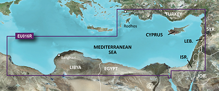
From Güllük, Turkey east to include Cyprus, Syria, Lebanon and Israel, then west to Misratah, Libya.
FID: 3490, PID: 1, RID: 2, VID: 22
Locked Image:
UnLocked Image:
 PiEtU Reviewed by PiEtU on . BlueChart g2 - HEU016R - Mediterranean Southeast 2014.5 [16.00] BlueChart g2 - HEU016R - Mediterranean Southeast 2014.5 (16.00) See your vessels precise, on-chart position in relation to navaids, coastal features, anchorages, obstructions, waterways, restricted areas and more with this detailed marine mapping data. Shaded depth contours, coastlines, spot soundings, navaids, port plans, wrecks, obstructions, intertidal zones, restricted areas and IALA symbols. Seamless transitions between zoom levels and more continuity across chart Rating: 5
-
The Following 1 Users Say Thank You to PiEtU For This Useful Post:
- [ Click To Expand ]
-
Stellatjejen (29th September 2017)
![BlueChart g2 - HEU016R - Mediterranean Southeast 2014.5 [16.00]](https://www.hostdel.com/banners/RDP/300X250.gif)

 Register To Reply
Advertisements
![BlueChart g2 - HEU016R - Mediterranean Southeast 2014.5 [16.00]](https://www.hostdel.com/banners/Dedicated/728x90.gif)
Suggested Articles:
![BlueChart g2 - HEU016R - Mediterranean Southeast 2014.5 [16.00]](https://www.hostdel.com/banners/GameServer/728x90.gif)

![BlueChart g2 - HEU016R - Mediterranean Southeast 2014.5 [16.00]](https://www.hostdel.com/banners/Email/300X250.gif)


 Staff Online
![BlueChart g2 - HEU016R - Mediterranean Southeast 2014.5 [16.00]](https://www.hostdel.com/banners/Dedicated/300x600.gif)
Garmin Cyclops Safety Cameras -...
Garmin Cyclops Jul-26 AustraliaNewZealand...