


![BlueChart g2 - HEU800X - Northern Europe 2014 [v15.50]](https://www.hostdel.com/banners/Hosting/728x90.gif)
Results 1 to 4 of 4
-
23rd April 2014, 08:40 PM #1
 Garmin Expert
Supporter

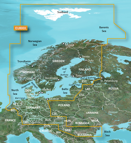
 BlueChart g2 - HEU800X - Northern Europe 2014 [v15.50]
BlueChart g2 - HEU800X - Northern Europe 2014 (v15.50)
See your vessel’s precise, on-chart position in relation to navaids, coastal features, anchorages, obstructions, waterways, restricted areas and more with this detailed marine mapping data.
- Shaded depth contours, coastlines, spot soundings, navaids, port plans, wrecks, obstructions, intertidal zones, restricted areas and IALA symbols.
- Seamless transitions between zoom levels and more continuity across chart boundaries.
- Standard 2-D direct overhead or 3-D “over the bow” map perspective for easy chart reading and orientation.
- Safety Shading* enables contour shading for all depth contours shallower than your defined safe depths.
- Fishing Charts* to scope out bottom contours and depth soundings with less visual clutter on the display.
- Plan and organize routes from your computer with HomePort™ (sold separately)
FID: 3258, PID: 1, RID: 18, VID: 1
Locked Image:
UnLocked Image:
PiEtU Reviewed by PiEtU on . BlueChart g2 - HEU800X - Northern Europe 2014 [v15.50] BlueChart g2 - HEU800X - Northern Europe 2014 (v15.50) See your vessel’s precise, on-chart position in relation to navaids, coastal features, anchorages, obstructions, waterways, restricted areas and more with this detailed marine mapping data. Shaded depth contours, coastlines, spot soundings, navaids, port plans, wrecks, obstructions, intertidal zones, restricted areas and IALA symbols. Seamless transitions between zoom levels and more continuity across chart boundaries. Rating: 5
-
The Following 1 Users Say Thank You to PiEtU For This Useful Post:
- [ Click To Expand ]
-
Mobile_Guru (24th April 2014)
-
3rd November 2017, 08:41 PM #2
Links are not working?!
Please check
-
2nd June 2022, 02:08 AM #3
can someone reupload this ..
-
11th June 2024, 06:20 PM #4
is this one available anywhere else?
![BlueChart g2 - HEU800X - Northern Europe 2014 [v15.50]](https://www.hostdel.com/banners/RDP/300X250.gif)

 Register To Reply
Advertisements
![BlueChart g2 - HEU800X - Northern Europe 2014 [v15.50]](https://www.hostdel.com/banners/Dedicated/728x90.gif)
Suggested Articles:
![BlueChart g2 - HEU800X - Northern Europe 2014 [v15.50]](https://www.hostdel.com/banners/GameServer/728x90.gif)
Similar Threads
-
BlueChart g2 Vision - VEU704L - France 2014.0 (15.50)
By p33dro in forum Garmin MapsReplies: 14Last Post: 23rd January 2024, 08:10 PM -
BlueChart g2 - HEU055R - Finnish Lakes 2014 [15.50]
By PiEtU in forum Garmin ArchivesReplies: 3Last Post: 5th March 2023, 05:07 PM -
BlueChart g2 - HXUS031R-Southwest Caribbean 2014.0 [15.50]
By p33dro in forum Garmin ArchivesReplies: 1Last Post: 27th March 2021, 10:00 PM -
BlueChart g2 - HEU800X - Northern Europe 2014 [v15.50]
By PiEtU in forum Garmin MapsReplies: 1Last Post: 3rd November 2017, 08:41 PM -
BlueChart g2 - HEU055R - Finnish Lakes 2014 [15.50]
By PiEtU in forum Garmin MapsReplies: 1Last Post: 14th August 2014, 12:34 AM

![BlueChart g2 - HEU800X - Northern Europe 2014 [v15.50]](https://www.hostdel.com/banners/Email/300X250.gif)


 Staff Online
![BlueChart g2 - HEU800X - Northern Europe 2014 [v15.50]](https://www.hostdel.com/banners/Dedicated/300x600.gif)
Garmin Cyclops Safety Cameras -...
Garmin Cyclops Jul-26 AustraliaNewZealand...