


![BlueChart g2 - HCA015R - Canada g2 v2015.0 [16.50]](https://www.hostdel.com/banners/Hosting/728x90.gif)
Results 1 to 10 of 25
Hybrid View


-
27th July 2021, 12:47 AM #1

can you reupload
This page is not allowed in the US
We're sorry but it appears your IP comes from the US so you're not allowed to download or stream.
If you have a premium account, please login to remove the limitation.
Moderator Note
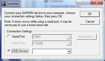
This block by your government or ISP is easily worked around with a Free VPN, you cannot expect another member sharing to upload to a host to suit you.jocker Reviewed by jocker on . BlueChart g2 - HCA015R - Canada g2 v2015.0 [16.50] BlueChart g2 - HCA015R - Canada g2 v2015.0 (16.50) See your vessels precise, on-chart position in relation to navaids, coastal features, anchorages, obstructions, waterways, restricted areas and more with this detailed marine mapping data. Shaded depth contours, coastlines, spot soundings, navaids, port plans, wrecks, obstructions, intertidal zones, restricted areas and IALA symbols. Seamless transitions between zoom levels and more continuity across chart boundaries. Rating: 5Last edited by Garmin_Nuvi; 28th July 2021 at 05:38 AM. Reason: Added note about using VPN
-
28th July 2021, 06:54 AM #2
Garmin Mod
Supporter
![BlueChart g2 - HCA015R - Canada g2 v2015.0 [16.50]](http://www.gpsurl.com/images/ranks/moderator.png) Unless you are a "New" member, having used the Thanks button regularly is the quickest way to get help.
Unless you are a "New" member, having used the Thanks button regularly is the quickest way to get help.
-
The Following 1 Users Say Thank You to Garmin_Nuvi For This Useful Post:
- [ Click To Expand ]
-
kap55 (28th July 2021)
![BlueChart g2 - HCA015R - Canada g2 v2015.0 [16.50]](https://www.hostdel.com/banners/RDP/300X250.gif)

 Register To Reply
Advertisements
![BlueChart g2 - HCA015R - Canada g2 v2015.0 [16.50]](https://www.hostdel.com/banners/Dedicated/728x90.gif)

Suggested Articles:
![BlueChart g2 - HCA015R - Canada g2 v2015.0 [16.50]](https://www.hostdel.com/banners/GameServer/728x90.gif)

![BlueChart g2 - HCA015R - Canada g2 v2015.0 [16.50]](https://www.hostdel.com/banners/Email/300X250.gif)


 Staff Online
![BlueChart g2 - HCA015R - Canada g2 v2015.0 [16.50]](https://www.hostdel.com/banners/Dedicated/300x600.gif)
Universal Firmware Patcher for...
[/url] ...