


Results 1 to 1 of 1
-
26th September 2014, 10:06 PM #1
 Garmin Expert
Supporter

 TOPO Australia & New Zealand v5 Lite
TOPO Australia & New Zealand v5 Lite
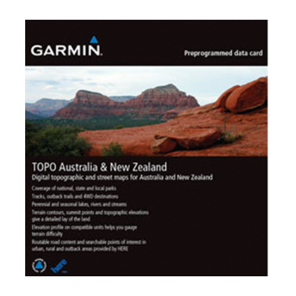
Get enhanced topographic detail on your compatible device whether you're in the outback or on a main boulevard in the city. This map provides a wide array of topographic information from terrain contours, elevations and summits to coverage of perennial and intermittent lakes, rivers and streams in Australia and New Zealand.
- Provides terrain contours and summit points at 40 m intervals for a more detailed view of the terrain
- Contains more than 105,000 km of tracks, roads and outback trails; also displays 4WD destinations and hydrographic features: lake/river shorelines and perennial and seasonal streams
- Shows national, state and local parks as well as parks and reserve areas
- Includes built-in DEM data with 3-D shading and route elevation profiles on compatible devices so you can estimate terrain difficulty
- Offers updated and new searchable points of interest in urban, rural and outback areas, including lodging, restaurants, homesteads, parks, camping locations and shopping
- Displays updated non-routable road content, by HERE, to give you turn-by-turn directions to your destination
Coverage
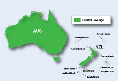
Features digital topographic and street maps for all of Australia and New Zealand. Also includes expanded coverage for several New Zealand islands, including Antipodes, Auckland, Bounty, Campbell, Kermadec, Chatham, Lord Howe, Snares, Stewart and Three Kings.
FID: 3551
Download:
PiEtU Reviewed by PiEtU on . TOPO Australia & New Zealand v5 Lite TOPO Australia & New Zealand v5 Lite https://static.garmincdn.com/en/products/010-C1119-00/g/cf-lg.jpg Get enhanced topographic detail on your compatible device whether you're in the outback or on a main boulevard in the city. This map provides a wide array of topographic information from terrain contours, elevations and summits to coverage of perennial and intermittent lakes, rivers and streams in Australia and New Zealand. Provides terrain contours and summit points at 40 m Rating: 5


 Register To Reply
Advertisements

Suggested Articles:


 Staff Online
Jeep Wrangler 430n
Trying to update my maps in Wrangler on the old...