


Results 1 to 2 of 2
-
9th May 2015, 07:53 PM #1
 Garmin Expert
Supporter

 Garmin GB Discoverer 1:50k v4 - Northern England & Midlands
Garmin GB Discoverer™ 1:50k v4 - Northern England & Midlands
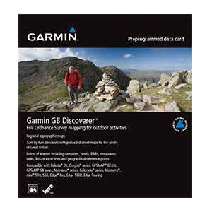
Explore Great Britain with detailed topographic data, including terrain contours, topo elevations, summits, paths, routable roads and geographical points. This product has routable roads and points of interest from NAVTEQ and full 1:50K scale Ordnance Survey Landranger map coverage for Great Britain.
- Includes terrain contours, elevations, summits, trails, trig points, campsites and geographic points.
- Provides the same detailed road data used in our automotive products, with thousands of addresses and points of interest, including lodging, food and drink, car parks, banks, petrol stations, attractions and campsites.
- Provides turn-by-turn directions on roads by car or bike.
- Search for destinations by address or by category.
- Includes Digital Elevation Model (DEM) for route profile planning.
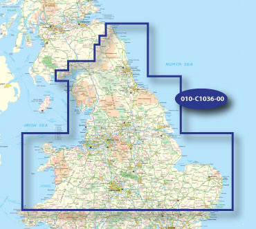
Coverage
Topographic coverage of Northern England and the Midlands. Includes northern England from Northumberland National Park and Kielder Forest Park to Lowestoft, the Norfolk Broads and the northern part of Wales, including Snowdonia National Park.
FID 3560, PID 1, region 2,2
Download Image:
 PiEtU Reviewed by PiEtU on . Garmin GB Discoverer 1:50k v4 - Northern England & Midlands Garmin GB Discoverer™ 1:50k v4 - Northern England & Midlands https://static.garmincdn.com/en/products/010-C1043-00/g/cf-lg.jpg Explore Great Britain with detailed topographic data, including terrain contours, topo elevations, summits, paths, routable roads and geographical points. This product has routable roads and points of interest from NAVTEQ and full 1:50K scale Ordnance Survey Landranger map coverage for Great Britain. Includes terrain contours, elevations, summits, trails, Rating: 5
-
6th March 2020, 04:12 PM #2
Links are dead, any mirrors?


 Register To Reply
Advertisements

Suggested Articles:


 Staff Online
iGO Primo NextGen 9.19.2.543580
linkler çökmüş. Yenileyebilirmisiniz